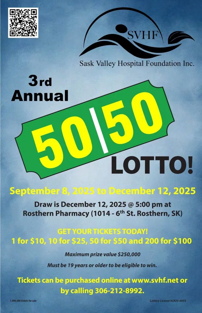


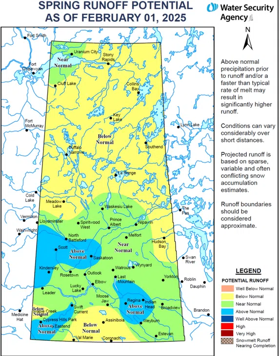
The Water Security Agency says the entire northern half of the province—including Meadow Lake, La Ronge and Hudson Bay in the south and all the way to the Saskatchewan/Northwest Territories border—can anticipate a below normal spring runoff.
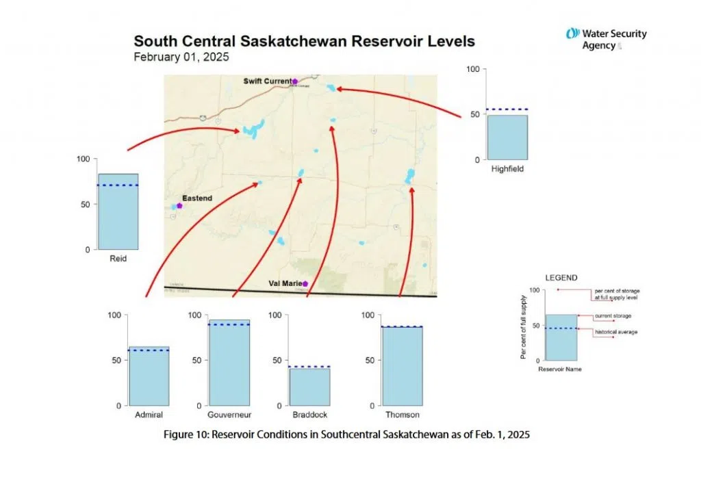
The other area looking at a below normal runoff is the south-central region, including Val Marie, Coronach and Assiniboia. These areas went through a dry fall and currently have a below normal snowpack. Most of the province went into winter with below or well below normal topsoil moisture. Two mid-November snowstorms boosted the snowpack in some areas but it’s too early to determine if the melting snow will sink into the soil or if frost in the soil will slow infiltration. The Water Security Agency says late February snow surveys will help determine which scenario is more likely for the spring runoff.
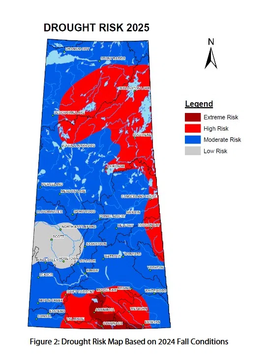
The Water Security Agency has also generated a drought risk map for 2025.
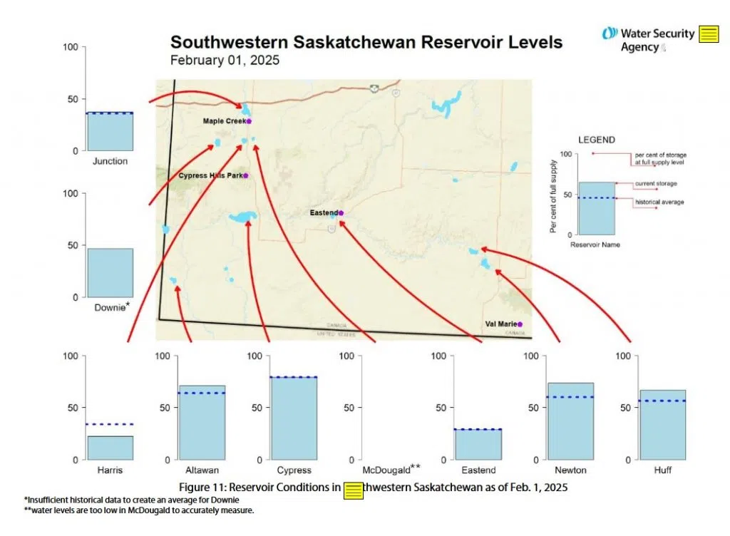
Winter precipitation has been variable across the province, ranging from below normal in south-central and northern Saskatchewan, to above normal in parts of the southwest and west central portions of the province.
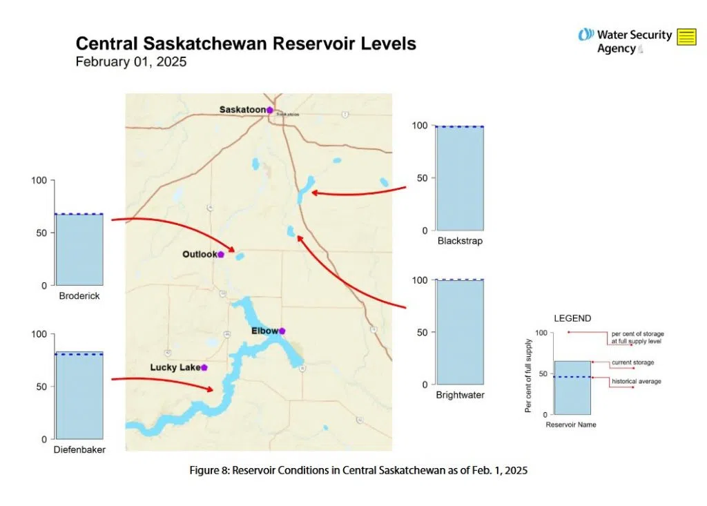
Currently, Lake Diefenbaker, the province’s main water supply, is above normal levels for this time of year and inflows this winter have been near normal.
A more complete assessment of potential runoff conditions will be available after snowpack survey data is gathered later in February. Snowpack data, collected from over 100 locations across the province, provides a comprehensive view of moisture conditions, helping to refine runoff forecasts and water management decisions.